Following the outcomes of community consultation, Council resolved at its Ordinary Meeting on 25 May 2026 to establish Memorial Avenue, Penrith as an Alcohol-Free Zone (AFZ). This zone will remain in effect until 30 June 2029 and aligns with existing AFZ’s established across the Local Government Area.
Signage will be installed along Memorial Avenue, Penrith in the coming weeks to clearly indicate the enforceable area, and the restrictions will be enforced by NSW Police.
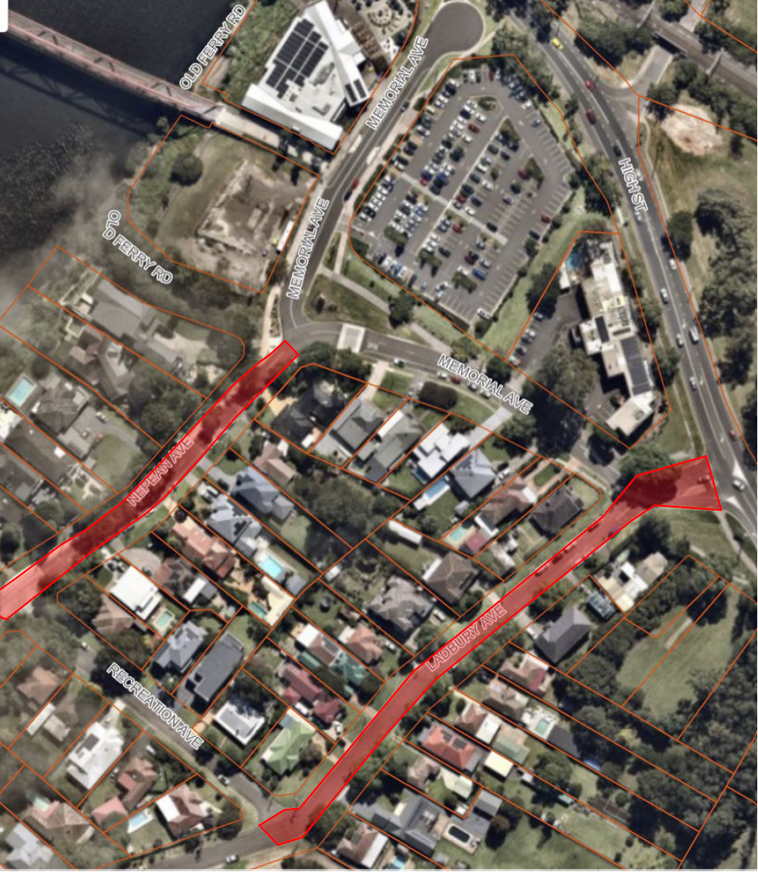
Further to feedback received through community consultation to establish Memorial Avenue, Penrith as an AFZ, Council is proposing to implement Alcohol-Free Zones at the following nearby locations until 30 June 2029:
- Nepean Avenue, from Memorial Avenue to Recreation Avenue
- Ladbury Avenue, from High Street to Recreation Avenue.
AFZs are established under Section 644 of the Local Government Act 1993 to prohibit alcohol consumption in public places where there is identified community need. The locations are supported by evidence, police statistics or community reports, of alcohol-related antisocial behaviour.
For more information and to view designated Alcohol-Free Public Spaces across the Penrith Local Government Area, please visit our website Alcohol Free Public Spaces.
Have Your Say
Council is inviting feedback from the community regarding the establishment of new Alcohol Free Zones at the above-mentioned locations.
Consultation is open for 30 days and closes at 5pm, Tuesday 30 June 2026.


